Travel
Scotland to be battered with 80mph winds, snow, sleet and hail

- Two yellow warnings are in force over the weekend covering all of the mainland and the Western Isles
-
 The Met Office has warned that the strong winds could lead to significant transport disruption, including ferry cancellations
 -
 With gusts of up to 80mph over the weekend, conditions could worsen to see the fifth storm of the season named
Scotland is to be battered by strong winds, snow, sleet and hail just days before Christmas.
With gusts of up to 80mph over the weekend, conditions could worsen to see the fifth storm of the season named.
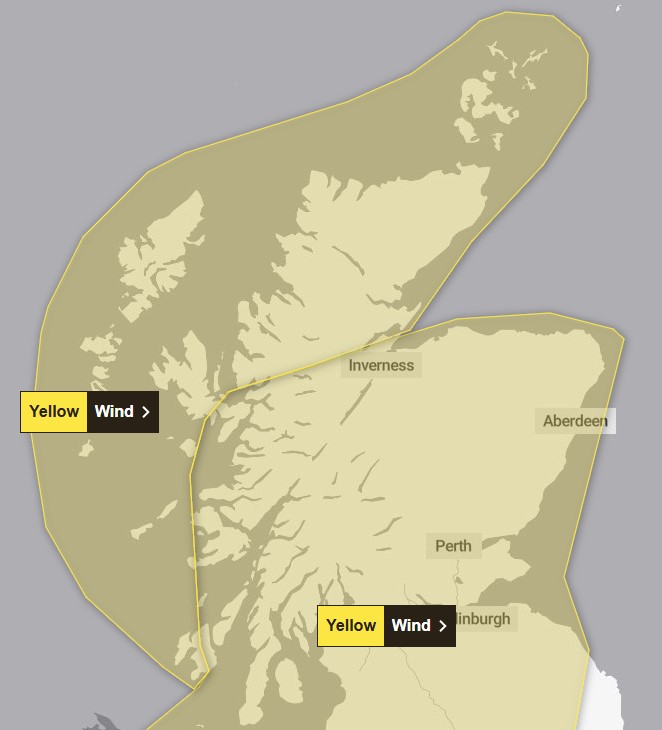
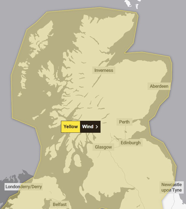
A first yellow weather warning for strong winds has been extended by the Met Office to cover all of the mainland, Orkney and the Western Isles.
The alert comes into force from 7am on Saturday, December 21, and will remain in force until midnight.
 Met Office
A second yellow alert is in force on Sunday, covering most of the country.
Forecasters have also warned that the wind could turn to hail, sleet, and snow over the weekend.
 Met Office
The Met Office has said that the strong winds could lead to significant transport disruption, including ferry cancellations.
Very strong westerly winds are expected to develop throughout Saturday with 65-75mph gusts in the Highlands, Orkney and Shetland and 50-60mph elsewhere.
Forecasters say there is a small chance that gusts of up to 80mph could occur across the Highland region.
Dangerous coastal conditions are expected with large waves.
When the Met Office issues warnings a couple of days in advance, it normally means we need to sit up and take notice.
This is the case with the current wind warnings for Saturday and Sunday, which are warning of gusts widely 50-60mph across the country.
This is due to a deep area of low pressure moving eastwards between Scotland and Iceland bringing with it widespread gales.
The strongest wind gusts will be through the day Saturday across the northern part of the country, with gusts of 60-80mph possible.
Along with the strong winds, we will also see frequent showers that will increasingly turn to hail, sleet and snow over the weekend – particularly overnight Saturday into Sunday, with the small chance of some snow to lower levels – but the majority will be on the hills before milder air returns on Monday to start Christmas week.
At the moment, there are no plans to name the low pressure a storm, but the Met Office is keeping an eye on things over the next 24 hours.
If it were to be named, it would be called Storm Eowyn, our fifth named storm of the season.
Follow STV News on WhatsApp
Scan the QR code on your mobile device for all the latest news from around the country


